
PangeAI
PangeAI is an AI-powered geospatial intelligence platform that transforms natural language queries into instant spatial analysis and decision-making outputs without requiring any GIS expertise.
https://pangeai.com/?ref=producthunt

Информация о продукте
Обновлено:08/05/2026
Что такое PangeAI
PangeAI is a Stanford-founded startup created by Johanna von der Leyen and Marek Miltner that democratizes access to geospatial intelligence through autonomous AI agents. The platform addresses a critical gap in the $100 billion geospatial intelligence market, where complex spatial analyses traditionally require specialized GIS experts and weeks of manual work. By leveraging frontier AI technology, PangeAI makes the physical world as searchable and understandable as the digital one, enabling businesses and public institutions to perform sophisticated geospatial analyses simply by typing plain-language questions. The company has already secured pilot partnerships with major organizations, including one of Japan's largest insurance groups and a leading global natural-capital investor, demonstrating real-world application before its full market launch.
Ключевые особенности PangeAI
PangeAI is an agentic AI platform that democratizes geospatial intelligence by enabling anyone to perform complex spatial analyses through natural language queries without requiring GIS expertise. Powered by autonomous AI agents, it automatically integrates diverse spatial datasets, regulatory information, and local knowledge to deliver map-based outputs in minutes rather than months. The platform targets the $100 billion geospatial intelligence market, focusing on sectors like energy, insurance, and natural capital where land, risk, and environmental context drive critical decisions.
Natural Language Interface: Users can ask geospatial questions in plain language without any GIS expertise, making complex spatial analysis accessible to non-technical professionals.
Autonomous Agent-Driven Analysis: AI agents automatically select the right analytical methods and execute complex spatial analyses and simulations within minutes, eliminating manual workflows.
Automated Data Integration: Seamlessly pulls and integrates data from both internal and external sources, combining spatial datasets, regulatory information, and local knowledge automatically.
Instant Map-Based Outputs: Generates fast, easy-to-understand map-based visualizations and outputs that enable rapid decision-making without requiring data science skills.
Scalable Spatial Reasoning: Performs advanced spatial reasoning autonomously and at scale, transforming weeks-long expert-driven projects into minutes-long automated workflows.
Варианты использования PangeAI
Energy Infrastructure Siting: Automates renewable energy site selection, feasibility screening, transmission corridor risk monitoring, and climate risk assessments, helping energy companies cut uncertainty and accelerate project development.
Insurance Risk Scoring: Enables property-level natural hazard scoring, portfolio exposure mapping, and accumulation analysis for insurance companies, as demonstrated by a major Japanese insurance group pilot partner.
Natural Capital Investment: Evaluates nature-based solutions opportunities, tracks land-use change and deforestation, and maps restoration potential to help investors identify high-impact ecological and financial opportunities, as used by a leading global natural-capital investor in South America.
Climate Risk Assessment: Provides fast climate and environmental hazard analysis for businesses and public institutions to understand where climate risks will impact infrastructure and operations.
Infrastructure Planning: Assists companies and public institutions in making complex decisions about where to build physical infrastructure by analyzing spatial, regulatory, and environmental factors.
Biodiversity and Conservation Mapping: Supports environmental organizations and governments in tracking biodiversity, identifying conservation priorities, and planning restoration projects through automated spatial analysis.
Преимущества
Eliminates the need for specialized GIS expertise, making geospatial analysis accessible to anyone
Dramatically reduces analysis time from weeks or months to minutes, enabling faster decision-making
Automates data integration from multiple sources, reducing manual data preparation work
Already securing enterprise pilot partnerships with major insurance groups and natural capital investors before full market launch
Недостатки
Product is still in development and not yet fully launched to market (listed as 'coming soon')
Limited public information about pricing structure and accessibility for different organization sizes
As a new startup, long-term reliability and support infrastructure remain to be proven
May require significant training data and validation to ensure accuracy across diverse geospatial use cases
Как использовать PangeAI
1: Join the waitlist - PangeAI is currently in 'coming soon' status and not publicly available yet. Save your spot by signing up on their website at pangeai.com
2: Once you have access to the platform, navigate to the web-based software interface (no installation required)
3: Ask your geospatial question in plain natural language - for example: 'How has this land changed over the last five years?' or 'What restoration opportunities exist based on ecological suitability?'
4: The AI agents automatically select the appropriate analysis methods and ingest relevant data from both internal and external sources
5: Receive instant, decision-ready answers in the form of map-based, easy-to-understand outputs within minutes
6: Review the geospatial analysis results without needing any GIS or data science expertise
Часто задаваемые вопросы о PangeAI
PangeAI is a geospatial intelligence platform powered by autonomous agents that turns natural language queries into geospatial outputs, requiring no GIS knowledge or expertise.
Видео PangeAI
Популярные статьи

Atoms: Мультиагентная ИИ-платформа, которая превращает идеи в готовые к запуску продукты
May 22, 2026

Nano Banana SBTI: Что это такое, как это работает и как это использовать в 2026 году
Apr 15, 2026

Обзор Atoms — AI Product Builder, переопределяющий цифровое творчество в 2026 году
Apr 10, 2026

Kilo Claw: Как развернуть и использовать настоящего AI-агента "Сделай-Это-За-Вас" (Обновление 2026)
Apr 3, 2026
Последние ИИ-инструменты, похожие на PangeAI

Snapmark
Snapmark — это поисковая система на основе искусственного интеллекта для закладок, которая позволяет пользователям сохранять, искать и организовывать веб-сайты, изображения и текст без ручного тегирования или категоризации.

Uměl.cz
Uměl.cz - это чешская поисковая система на базе ИИ, которая предоставляет интеллектуальные и контекстуальные ответы на запросы пользователей.

ReviewPower
ReviewPower — это универсальная платформа, которая агрегирует и анализирует надежные отзывы с G2 и Capterra, чтобы помочь компаниям получать ценные прозрения из отзывов клиентов.

AskWiki
AskWiki - это программное обеспечение семантического интеллекта и поисковая система на естественном языке, которая позволяет пользователям задавать вопросы по содержимому Википедии и получать конкретные, точные ответы.
Популярные ИИ-инструменты, похожие на PangeAI

SearchGPT
SearchGPT - это прототип поиска с искусственным интеллектом от OpenAI, который обеспечивает быстрые, разговорные ответы с четкими источниками, используя модели GPT.

DuckDuckGo AI Chat
DuckDuckGo AI Chat — это бесплатный и анонимный способ доступа к популярным чат-ботам AI, таким как GPT-3.5, Claude и другим, сохраняя при этом конфиденциальность пользователя.

R2R
R2R (Reason to Retrieve) — это продвинутая система извлечения информации на основе ИИ, которая предоставляет готовые к использованию возможности Retrieval-Augmented Generation (RAG) с мультимодальным поглощением контента, гибридным поиском, графами знаний и комплексным управлением документами через RESTful API.
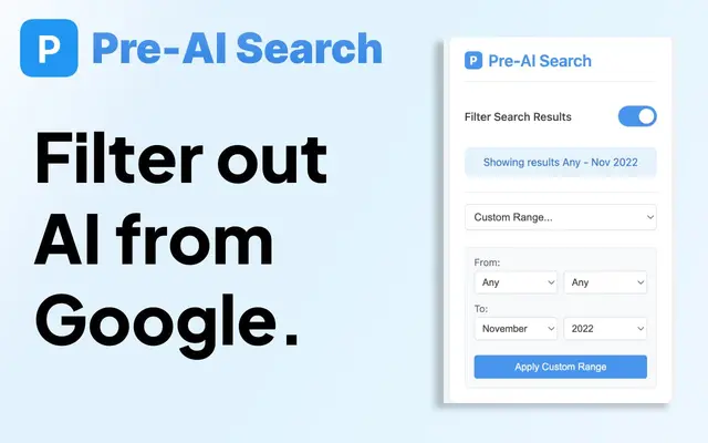
Pre-AI Search - Filter Google AI Content
Pre-AI Search - это расширение для Chrome, которое помогает пользователям фильтровать контент, сгенерированный ИИ, из результатов поиска Google, сосредотачиваясь на контенте, опубликованном до появления генерации контента ИИ.